What to Know Before Building a Custom Home on Lake Wylie
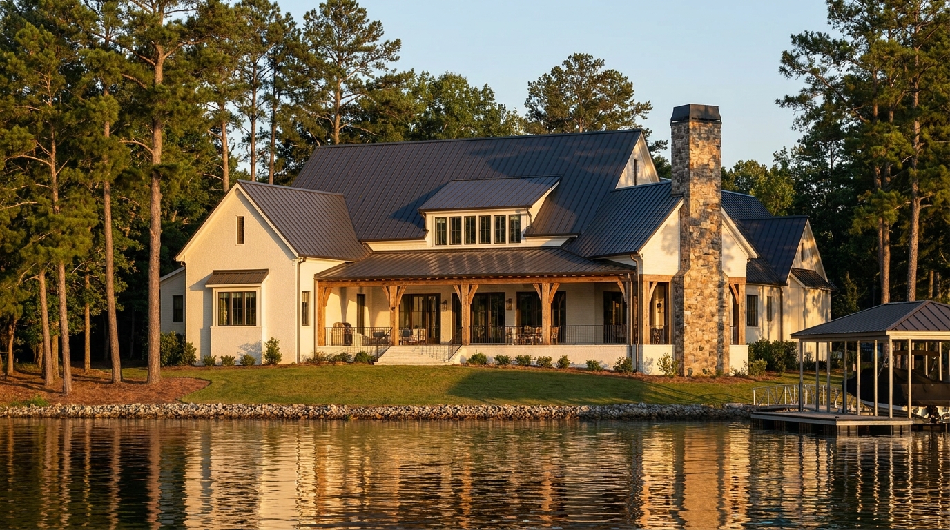
If you are planning a custom home Lake Wylie, start with the shoreline, the floodplain, and the soils, not with the great room. The reservoir sits on the Catawba River between Charlotte and Rock Hill, with about 12,177 acres of water, and Duke Energy manages it as a hydroelectric project under a Federal Energy Regulatory Commission license. [1][2] Before you draw a floor plan, you need a clear read on four things that sit on top of ordinary zoning: Duke Energy shoreline permits, vegetated buffers and setbacks, floodplain and soils, and whether the lot can take public water and sewer or must carry a well and septic system. Those constraints decide where the house can sit, whether a dock is even eligible, and how the home should be built so it still makes sense fifty years from now.
The lake is a working reservoir
Lake Wylie is one of the oldest reservoirs on the Catawba. The South Carolina Department of Natural Resources notes it was first created in 1904 by a dam near Fort Mill, rebuilt in 1924, and later named for Dr. W. Gil Wylie. It supplies cooling water for generating stations and drinking water for Rock Hill, South Carolina, and Belmont, North Carolina. SCDNR lists about 325 miles of shoreline in total and 7,316 of the lake's acres on the South Carolina side, in York County. [1] That history matters on a building site because the water is not a private amenity. It is a shared, licensed resource.
Duke Energy's Catawba-Wateree Shoreline Management Plan is the document that guides construction, shoreline stabilization, and excavation inside the lake boundaries of the eleven-lake Catawba-Wateree system, including Wylie. The stated goal is continued public and private access while protecting natural and cultural resources. [2] In practice, the land you own in fee often stops at or near the full-pond contour. Activity lakeward of that line, or on Duke-owned peripheral strip, is a privilege Duke Energy can grant only when it is consistent with the FERC license and the shoreline plan.
We pour footings on lots like this. The first survey we want to see is not only the property lines. It is the project boundary, the flood zones, and the buffer measured from full pond. A house that ignores those lines will spend its first year in redesign, not in construction.
Shoreline use is permitted, not assumed
Want a dock, a shoreline wall, or a path to the water? Start with Duke Energy Lake Services, not with a contractor who promises to handle the lake later. Duke Energy requires written authorization before you implement activities on its lake property or within the FERC Project Boundary. Applications run through the Lake Access Permit System. A complete lake-use file typically includes a registered survey, plan and profile drawings, county or local building permits, and, for shoreline stabilization, a state permit from the North Carolina Division of Water Resources or the South Carolina equivalent. [3]
A rule that catches a lot of vacant-lot buyers: effective July 1, 2026, Duke Energy no longer reviews private dock applications where no home is constructed on the adjoining lot. The change applies to all Duke Energy lakes. It does not apply to shoreline stabilization requests. [3] If you are buying vacant waterfront with the idea that a dock comes first and a house later, that sequence is now closed on the dock side.
Stabilization itself is not a decorative choice. Wave action, fluctuating pool levels, and clay banks will move soil if you leave a raw cut. The shoreline plan and the county both treat that work as an environmental activity, not as landscaping. Budget time for that permit track in parallel with the house, not after the certificate of occupancy. Contractors who need to launch materials from a Duke access area also need a separate access-area use permit. [3]
Buffers, setbacks, and the buildable envelope
Lake Wylie straddles the state line. The rules are related, but they are not identical.
On the North Carolina side, the Catawba River Basin buffer rule is specific. 15A NCAC 02B .0614 protects a 50-foot-wide riparian buffer along the North Carolina portion of Lake Wylie, measured landward from full pond. Zone 1 is the first 30 feet and is to remain undisturbed except for listed uses. Zone 2 is the next 20 feet. New on-site sanitary sewage systems that use ground absorption are prohibited in that buffer. View corridors are tightly limited: thinning of underbrush, shrubs, and limbs, with no removal of woody stems larger than three inches diameter at breast height, and soils left undisturbed. [4]
South Carolina lots sit under York County's zoning code. The county maintains a Lake Wylie Overlay around the reservoir and a separate riparian-buffer layer (formerly the Lake Wylie / Catawba River Buffer) along the shoreline and the perennial streams that drain to it. Those overlays regulate structures, grading, vegetation removal, view corridors, and shoreline stabilization. Current code places the overlay boundary in Chapter 155 and the riparian-buffer standards in Subpart 3.5 of the same chapter. [5] County planning staff, not a listing photo, will tell you the current buffer width and what is allowed in it. Do not assume a lawn to the water, a pool in the buffer, or a septic field that just fits between the house and the shoreline.
Those two layers (Duke's project boundary and the county or state vegetated buffer) shrink the true building envelope more than a suburban setback table ever does. A lot that looks deep on the plat can lose fifty feet or more at the water, plus ordinary front and side yards, plus a septic repair area, plus any floodplain that cannot take a house. We have seen otherwise generous lots that could not carry the bedroom count the buyer wanted once those overlays were drawn.
Floodplain, soils, and the first floor
Lake lots collect water. York County's Floodplain Management Division administers Chapter 151 (Flood Damage Prevention), last revised on June 3, 2024, and it uses FEMA's Flood Insurance Study and Flood Insurance Rate Maps as the base for special flood hazard areas. Repairs and new work in the floodplain require a floodplain development permit. The county also maintains a flood map viewer so you can see whether a parcel sits in a mapped hazard area before you write an offer. [6]
Under the National Flood Insurance Program, communities must require that new residential structures in Zones AE (and related zones with a published base flood elevation) have the lowest floor, including basement, elevated to or above the base flood level. Enclosed areas below that floor, if used only for parking, access, or storage, need flood openings that let water in and out. [7] A walk-out basement toward the lake is a common drawing-board idea. On a mapped floodplain lot it is often the wrong idea. York County's floodplain office is explicit that standard homeowners insurance does not cover flood. If the house is in a special flood hazard area, flood insurance is a separate policy, and the elevation of the first floor is what the rate is built on. [6]
York County's land-development standards add a blunt suitability test. The Planning Commission is not to approve a subdivision where the state environmental agency has determined the soils are not suitable for the development proposed, and lands subject to flooding are not to be platted for residential occupancy. [9] That is a platting rule, but it is also a warning for an individual lot: if the soils or the floodplain cannot support the use, the county is not going to paper over it.
Piedmont clay, shallow rock, and a high seasonal water table are ordinary conditions around this lake. South Carolina's onsite wastewater regulation treats soils with substantial expansible-layer clays as unsuitable for a standard system. It also requires a usable repair area equal to at least 50 percent of the original system on a new site, free of buildings, easements, and other encroachments. Vertical separation from the zone of saturation must be at least six inches below the deepest point of effluent application for systems under 1,500 gallons per day. [10] A soils evaluation is not a formality. It is the difference between a conventional field and an engineered system, or between a buildable lot and a lot that should stay a lot.
Well, septic, or public utilities
Call the utility that actually serves the parcel. York County Water and Sewer operates in defined service areas in eastern and western York County. It purchases treated water from the City of Rock Hill, serves more than 22,000 retail customers, and collects sewer for treatment at Rock Hill's Manchester Creek plant. That office does not maintain wells and does not install or approve septic tanks. [11] Municipalities around the lake (Tega Cay, Clover, Rock Hill, and others) have their own systems. Availability is a map question, not a neighborhood rumor.
If public sewer is not available, you need a septic system. If public water is not available, you need a residential well. The South Carolina Department of Environmental Services tells buyers to confirm both before they close, and to confirm there is room for the required separations. Among the distances: 5 feet from buildings and property lines, 75 feet from a private well, 100 feet from a public well, 75 feet from surface water, and 25 feet from a drainage ditch. Sandy soils take less area than clay. A six-bedroom house takes more field than a three-bedroom house. Bedrock, steep slopes, flooding, wetlands, and fill dirt are listed as problem signs. Not every property is suitable for a septic system. Where a conventional or alternative standard cannot be issued, an engineered (610) system is an option, at higher cost and often with greater separations. [12]
On a lake lot those numbers collide. The house wants to sit high and face the water. The septic field wants well-drained soil, distance from the shoreline, distance from the well, and a repair area that is not under the driveway or the patio. The well wants distance from the septic field and from surface water. State regulation puts no part of the system (excluding solid pipe) within 75 feet of the mean high-water elevation of an impounded or natural body of water. [10] We layout all three before we freeze the floor plan. Bedroom count is a wastewater number as much as it is an architectural number.
Design it as a lasting home, not a weekend cabin
The water will always be the reason you bought the lot. It should not be the only thing the house is good at. A lake house that is all screen porch and no storage, all glass and no shade, all weekend circulation and no everyday kitchen, ages poorly. Legacy is built, not bought. What we build today should still make sense 50 years from now.
On our Lake Wylie work we treat outdoor living as structure, not as leftover budget. Evergreen 1 is a modern custom home on the lake with expansive balconies and Trex decking. Lake View is a ranch oriented to the water, with outdoor heaters so the terrace stays usable when the evening cools. Both are houses first: real kitchens, real baths, real envelopes. The lake is the setting.
A few design rules we apply on these lots:
- Put the primary living level on the view without putting habitable floor below the flood elevation.
- Keep mechanical equipment and the electrical service above flood and splash, and out of the buffer.
- Size porches and decks to the sun and the wind, not only to the listing photo. West-facing glass on a summer afternoon on this lake is a mechanical load unless you shade it.
- Leave an honest path to the water that meets Duke and county rules, instead of clearing a lawn that will erode and then need a wall.
- Build the envelope for year-round occupancy. If the house cannot hold heat and quiet in January, it is a cabin with a good address.
We are a building company, not just a new-home builder. If you already own a house on the lake and the problem is an addition, a better kitchen, or a rebuild on the same lot, that is the same kind of work. The shoreline rules do not get easier on a renovation. They often get tighter, because existing nonconformities have to be mapped before anything new is added.
A practical sequence before you buy or break ground
Our process on a lake lot is deliberately front-loaded, and it matches the order in which the agencies actually work.
- Confirm jurisdiction. York County unincorporated, Tega Cay, Clover, or the North Carolina counties on the far shore are not the same permit stack.
- Pull the FEMA flood map for the address and, if the lot is in or near a special flood hazard area, talk to the floodplain administrator before you sketch a basement. [6][8]
- Have a surveyor show full pond, the Duke project boundary, the county buffer, easements, and existing structures.
- Ask Duke Energy Lake Services, early, whether the shoreline classification even allows the dock or stabilization you have in mind, and whether a house must exist before a private dock will be reviewed. [2][3]
- Confirm water and sewer in writing with the utility that serves that map, or start the SCDES well and septic path with a soil evaluation. [11][12]
- Only then freeze bedroom count, finished floor elevation, and the outdoor program.
That sequence is slower than a production-home schedule. It is faster than redesigning a house after the dock is denied or the septic field will not fit.
Owner Eric Brown is on site daily. On a lake lot that matters, because the questions (where the footer sits relative to rock, how the drainfield is protected during grading, whether the view corridor is a thinning or a clearing) are field questions. They do not get resolved by a remote project manager. Our process is built around that kind of site work.
Practical takeaways
- Treat Duke Energy shoreline approval as a gate, not a courtesy. No house on the lot now means no new private dock review after July 1, 2026. [3]
- Measure the buildable envelope from full pond, through the vegetated buffer, through floodplain and septic setbacks, then through ordinary zoning yards. The leftover is the house.
- On the North Carolina shore, plan for a 50-foot Catawba buffer and do not put a new ground-absorption septic system in it. [4]
- Pull the FEMA map and budget the first floor at or above the base flood elevation if you are in a mapped AE zone. Walk-out basements toward the water are often incompatible with that rule. [7]
- Confirm public water and sewer in writing. If you are on well and septic, the 75-foot surface-water and well separations will compete with the view you bought. [12]
- Design a year-round house. Porches, decks, and a path to the water should serve the architecture, not replace it.
How we can help
If you are looking at a lot on Lake Wylie, or at a house that already sits on one, we will walk the site with you, sort the Duke, county, flood, and septic constraints, and tell you plainly what the lot will and will not support. Our process is built for custom work on lots like this, and our Lake Wylie projects are the record. When you are ready to talk about a specific parcel, start a consultation.
Citations
- South Carolina Department of Natural Resources, "Lake Wylie" (n.d.)
- Duke Energy, "Catawba-Wateree Shoreline Management Plan" (current)
- Duke Energy, "Permits for Shoreline Activities" (current; dock-without-home rule effective 2026-07-01)
- North Carolina Administrative Code, 15A NCAC 02B .0614, "Catawba River Basin: Protection and Maintenance of Existing Riparian Buffers" (readopted 2020-06-15)
- York County, SC / Esri ArcGIS, "Zoning Overlay Buffer" (updated 2025-10-29)
- York County Planning and Development Services, "Floodplain Management" (Chapter 151 revised 2024-06-03)
- eCFR, 44 CFR 60.3, "Flood plain management criteria for flood-prone areas" (current as of 2026-08-27)
- FEMA Flood Map Service Center, "Flood Map Service Center" (current)
- York County, SC, "Chapter 154: Land Development Code" (§ 154.017 Land Suitability; amended 2026-02-16)
- S.C. Code Regs. 61-56.200, "Minimum Site Conditions for Onsite Wastewater Systems" (amended 2025-05-23)
- York County Water and Sewer, "Water & Sewer" (current)
- South Carolina Department of Environmental Services, "Before You Buy Land" (current)